Skip to main content
Code 587 Technologies and Products
Lunar Navigation Determination System (LaNDS)
Principal Investigator (PI)
Description and Objectives
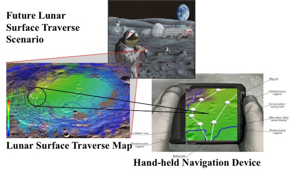
- Robotic & human explorers will need to precisely determine their location and heading while conducting short duration exploration sorties and long distance / long duration lunar surface traverses.
- Develop and demonstrate a self-contained, celestial-based lunar surface navigation technology to determine position and bearing on the lunar surface that neither relies on other information sources nor the existence of a lunar communications infrastructure.
Technical Approach
- Leverage available components:
- GSFC GEONS ( GPS-Enhanced Onboard Navigation System) navigation software
- Celestial Navigation (CelNAV) algorithm
- ILIADS (Integrated Lunar Information Architecture for Decision Support)
- Lunar GIS (Geographic Information System) software
- Celestron's SkyScout celestial body locator
- SkyScout output drives integrated GEONS-CelNav algorithms to establish position state.
- ILIADS displays lunar surface position and uncertainty.
Main Innovation(s)
- Prototype lunar surface navigation system that can be used anywhere on the lunar surface.
- Potential to provide a reliable, easy to use navigation capability without reliance on a space-based lunar geolocation satellite system or a lunar surface communications infrastructure.
Infusion Potential
- Potential for designing/developing a prototype hand-held unit.
- Integration into Lunar Electric Rover (LER) and EVA suits.